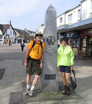
 The West Highland Way runs for 152 kms from Milngavie north to Fort William - from the outskirts of Scotland's largest city, Glasgow, to the foot of its highest mountain, Ben Nevis, 1344m, along the shores of it's largest loch, Loch Lomond, and across it's grandest moor. The walking is in part an easy stroll though fields peppered with sheep and the cutest little lambs, along twisty paths with short steep climbs and ascents and often over old cobblestone roads littered with loose stones along the trail. It is a walk that anyone in reasonable shape can enjoy. Gord and I ended each day at a welcoming B & B with a warm shower and clean sheets! Fortunately for us too, we were greeted with sunshine, which remained with us for the entire 7-day hike, with the exception of rain late on afternoon and evening. We were probably a week ahead of the "midges" - Scotland's answer to our blackfly, and according to the Highlanders, much more deadly!
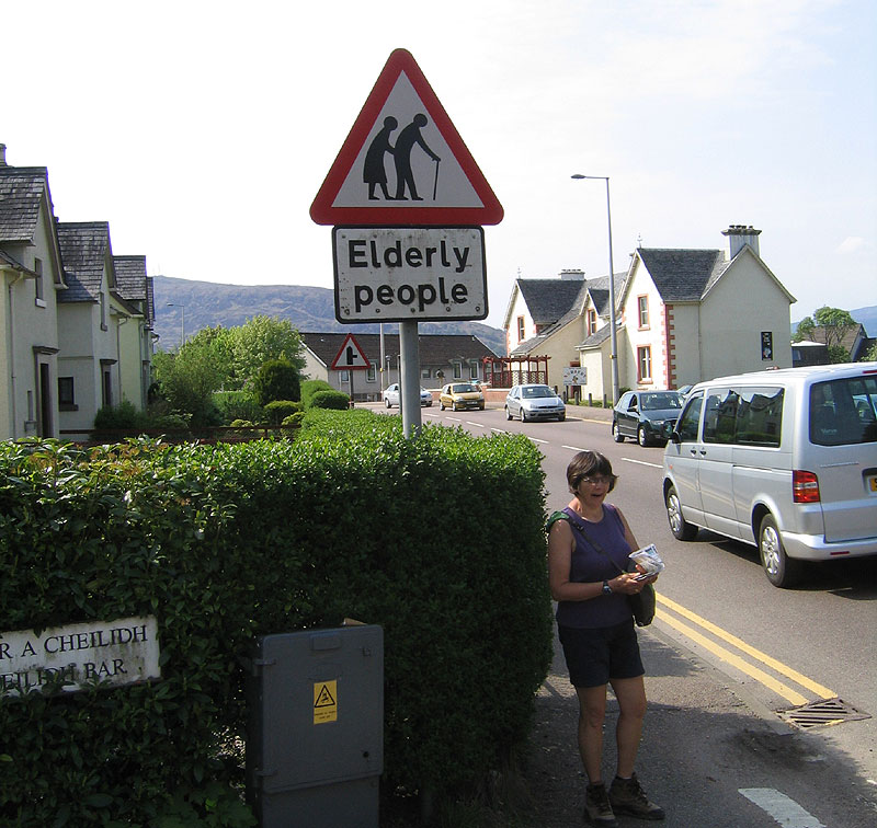
We landed at Glasgow airport, bussed into the city and hopped a train to Milngavie where we walked to our B & B, rested for a couple of hours, and set out to see the sights. It's a lovely town with shops surrounding a square. As the weather was good, lots of people were milling about. Bought our supper at Marks and Spencer - smoked salmon, a couple of salads, and a sweet dessert and ate at our B & B. We retired early for the BIG start in the morning. Breakfast at 8 am .We met 3 hikers from Holland (1 man and 2 women) who had also landed in Glasgow the previous day - but they HIKED to Milngavie from the airport. I was feeling quite humbled!
We had arranged to have one of our packs transported to our evening B & B's throughout the duration of the hike. Gord carried one pack with any supplies we might need during the day.
Day 1 - Milngavie to Drymen
 A very gentle start to the hike. Well packed paths from the town into the countryside. The landscape was rolling hills, rich farmland and some small villages. We walked on old roads, paths and abandoned rail lines. Many spring wild shrubs were in bloom. Pretty scenery. Easy day. Arrived in Drymen around 3 pm. Called our B & B, which was a few kms out of town, and the owner picked us up and dropped us at the trail the next morning around 9:10 am.
Met many hikers who we would continue to see throughout the next 7 days.
Breakfast is never served earlier than 8am, so no Gonzo starts on this trip!
Day 2 - Drymen to Rowardennan
 The start of the walk was through a forest. Lots of hikers - met a few who were camping and would take more or less than the 7 seven days depending on weather and how they were feeling.
The interesting thing about the hike is how well it is adapted to the 7 day schedule. No day is extremely long and there are natural "breaks" at noonish and mid afternoon - always seemed to be a pub at lunch and the walk wrapped up around 3 pm.
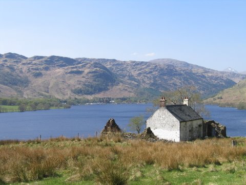
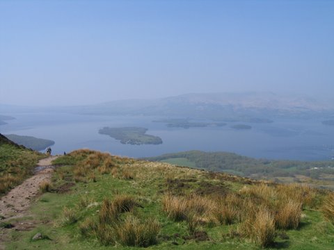
Our first major climb was over Conic Hill (358m). The view was gorgeous. We could see the beginning of Loch Lomond. The water glimmered, as it spread out before us and on the shores of the loch and nestled into the trees was the small touristy village of Balmaha. This was our destination for lunch at the local…you guessed it….pub!
Loch Lomand is the largest body of inland water in Britain, covering over 70 sq kms and is 37 kms long. The West Highland Way follows the eastern shore of the loch for about 30 km.
After lunch, the hike was a loch side route to Rowardennan which proved to be quite twisty, undulating with great views of the water as we wound through the woods.
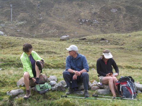
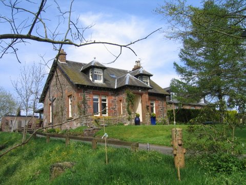
Rowardennan is not a town as you would expect, but a hotel well placed for vacationers set to enjoy Loch Lomond. We actually passed our B & B as we made our way to Rowardennan. Once we reached the hotel, we called our hostess, who met us and transported us back to the B & B with 2 other guests, Mandy and Steve, who we hiked with on and off throughout the week. This was our nicest B & B and most expensive at 70 pounds per night/double room. Free Internet and whiskey! Great breakfast!
Looking down from Conic Hill at Loch Lomond
Day 3 - Rowardennan to Inverarnan
 By all accounts, this is the roughest section of the Way, particularly the second half of the day from lunch at Inversnaid. The path is narrow. You are in the woods, beside the loch. It's twisty, up and down - very much like hiking the Admiral Lake Loop around Skull Rock. Can be steep in places, but only for a few feet. The scenery is superb.
For lunch we stopped at Inversnaid - again a hotel appealing to tourists. During the second leg of the hike, Gordon and Mandy took a dip in Loch Lomand at one of the beaches along the way. This was possibly the best day of the hike in terms of beauty and landscape. We were tired when we got to Inverarnan, but pleased with the day. All the hikers met at the Drovers Inn for a pint and later dinner. There isn't much in Inverarnan but the Inn, a couple of B & B's and small "hotels". The Drover's Inn is so named as it was the end point of the journey the farmers made with their sheep as they "drove" them to the train, which transported them to market. The Drover's Inn was named the best inn in Scotland in 1705!
Day 4 - Inverarnan to Tyndrum
 Followed the river Falloch the first half of the day. Pleasant walk with nothing of note
vis a vis terrain, scenery etc. We are in the highlands and mountains spread out around us. There are wooded and open areas. Vegetation is lush and green, many yellow shrubs blooming. Pretty. We took a spur off the trail into Crainlarich for an early lunch (was this or nothing till the end of the day). Ate at a tea house and met 2 cyclists from England who had started at Land's End and were biking 100 miles a day for 8 days to the most northerly part of Scotland. They said the biking was good, traffic decent on the secondary roads and the drivers considerate.
Followed the river Falloch the first half of the day. Pleasant walk with nothing of note
vis a vis terrain, scenery etc. We are in the highlands and mountains spread out around us. There are wooded and open areas. Vegetation is lush and green, many yellow shrubs blooming. Pretty. We took a spur off the trail into Crainlarich for an early lunch (was this or nothing till the end of the day). Ate at a tea house and met 2 cyclists from England who had started at Land's End and were biking 100 miles a day for 8 days to the most northerly part of Scotland. They said the biking was good, traffic decent on the secondary roads and the drivers considerate.
When we arrived at our B & B it was 3ish and had begun to cloud over and rain lightly. We sat on the doorstep til 4 when it finally opened for guests! Nice village. Well cared for. Gord had some fabulous fish and chips for supper. I was longing for fresh veggies, so I opted for salmon and a salad. Fish and chips was the better choice!
Day 5 - Tyndrum to Kingshouse
 Sometime in the seven days you have to hike a "long day' and this was it for us. After a brief snack at the Bridge of Orchy we continued to Inveroran and had a quick lunch. From here to Kingshouse we would be hiking on the moors along a road, quite straight, built by soldiers many years ago. In the past, the moors were forest, but the trees have all been forested, leaving the landscape very barren. We were quite high, providing many lovely views of the mountains and lochs. Occasionly we passed sheep, lambs and ruins of stone cottages. The walking was not difficult, but the road was covered with loose stones which made for rough terrain, hard on the soles of your feet. There is absolutely no trace of civilization along this stretch of the Way til Kingshouse at the end of the day. Lots of locals hiking here. I understand that many find the moors captivating and are drawn to their special "magic". This part of the trail is dangerous if the weather is foggy and wet. The rain can come down sideways.
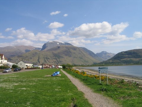
At Kingshouse we called our innkeeper, who picked us up. We actually stayed in Glencoe, another lovely village, about 10 miles from Kinghouse. There is a ski hill at Kingshouse. The Glencoe area is beautiful. You are encapsulated in mountains. It was in 1692 that the infamous Massacre of Glen Coe took place.
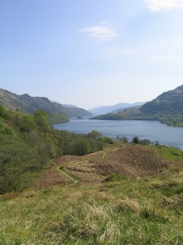
Looking at a loch from the moors
Day 6 - Kingshouse to Kinlochleven
 Today we climbed the Devil's Staircase, so named not because it is a terrible climb, but because it was a difficult engineering feat for the 450 soldiers who had to build it! It was a bit of a twisty climb, quite steep, but only for ˝ a km. The highest point was 500m at the top, and the rest of the day spent descending into Kinlochleven on an old road. We had glorious mountain views throughout the day. The view into Kinlochleven was fantastic - the tiny village is nestled among trees waaaay down! We did manage to get off trail during our descent, and hiked for 10 mins over the worst terrain of the entire week, along side of 6 water pipes heading straight into the town.
We stayed MacDonald House, a nice hotel which served up a great supper and breakfast. The genetleman who checked us in had an unusual Scottish accent - "refined" as a result of spending a fews years at UCLA on a track scholarship!
Day 7 - Kinlochleven to Fort William
 The last stage started with a steady climb out of town on a good track over the Lairig Mor and another climb through a forest into Glen Nevis, reaching a height of 250m and giving fine views of Ben Nevis and surrounding hills. The final streatch was on a road leading into the busy village of Fort William, which by this time looked like a mini city to us!
We stayed 2 nights here, before returning to Glasgow and our flight home.
The last stage started with a steady climb out of town on a good track over the Lairig Mor and another climb through a forest into Glen Nevis, reaching a height of 250m and giving fine views of Ben Nevis and surrounding hills. The final streatch was on a road leading into the busy village of Fort William, which by this time looked like a mini city to us!
We stayed 2 nights here, before returning to Glasgow and our flight home.
Nancy
|