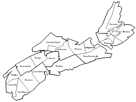
For the benefit of those researchers unfamilier with the geography of Nova Scotia, here is a map showing the boundaries of the various counties:
* County Seat
| County | Formed | Part of/Comments |
|---|---|---|
| Annapolis | 1759 | Formerly part of Halifax Co. |
| Antigonish | 1784 | Formerly part of Halifax Co. ** |
| Cape Breton | 1784 | A seperate colony from 1784 to 1820; A county since 1820. |
| Colchester | 1835 | Formerly a district of Halifax Co. |
| Cumberland | 1759 | Formerly part of Halifax Co. ** |
| Digby | 1837 | Formerly part of Annapolis Co. |
| Guysborough | 1836 | Formerly part of Halifax Co. ** |
| Hants | 1781 | Formerly part of Kings Co. |
| Inverness | 1835 | Formerly part of Cape Breton Co. |
| Kings | 1759 | Formerly part of Halifax Co. |
| Lunenburg | 1759 | Formerly part of Halifax Co. |
| Pictou | 1835 | Formerly a district of Halifax Co. |
| Queens | 1762 | Formerly a part of Lunenburg Co. |
| Richmond | 1835 | Formerly a part of Cape Breton Co. |
| Shelburne | 1784 | Formerly a part of Queens Co. |
| Victoria | 1851 | Formerly a part of Cape Breton Co. |
| Yarmouth | 1836 | Formerly part of Shelburne Co. |
Notes: ** From 1784 to 1836, Antigonish and Guysborough counties together
formed Sydney Co.
Until its creation as a separate colony in 1784, Cumberland
county included parts of what is now New Brunswick.
Last Modified: October 5, 1997