|
|
|
|
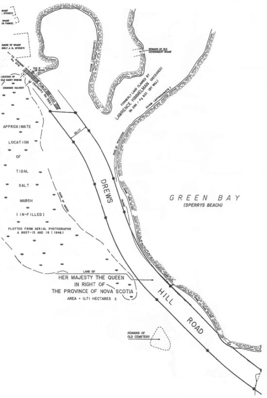
This tidal salt marsh or wetland flooded every high tide through a watercourse under the Drew's Hill Road. Spanning this watercourse was a bridge, known locally as 'The Cassy Bridge' (shown on August 22, 1995 DNR survey as "location of Old Casey Bridge"
 Note:
Note:
from a DNR survey dated August 22, 1995. It was reduced on a photocopier, scanned, and 'cleaned' to remove survey control point data, compass bearings, fold marks etc for graphic clarity. The original has the following information in the Title block:
- Index Sheet 40
- C.L.F.S. P-17
- Resource Map
10 44 2000 64 400
21A/01-A1
- Order of Survey S - 127/92
- Field Plot P-110/95
- signature of Bruce E. Turner
|
|