Despite its relative volatility in size and shape over the last half of the 20th century, the existence of the sand spit has been noted as far back as the early 1800's.
It appears labelled "Sand Beach" on a drawing "Plan of Land- John Parks to Jacob Sperry 1824"
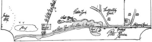
It appears on a British Admiralty chart "Port Medway to Lunenburg- surveyed by Captain P. F. Shortland RN" dated 1862
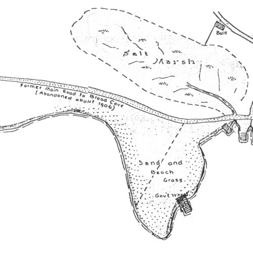
It appears, labelled "Sand and Beach Grass", on a drawing "Plan of Property at Petite Riviere, N.S.". The notes state "Buildings, lines and shore are as located about 1935" "Prepared October 1946" "Original by C.W. Sperry, Redrawn George T. Bates-1964".