|
|
|
|
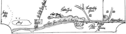
The wetland appears, labelled "Salt Marsh", on a drawing "Plan of Land- John Parks to Jacob Sperry 1824". The watercourse under the "66 Ft Public Road Along Shore to Broad Cove" is present, and two ponds are also labelled.
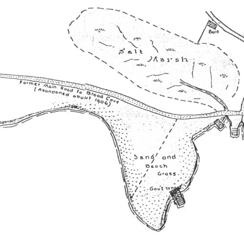
The wetland appears, labelled "Salt Marsh", on a drawing "Plan of Property at Petite Riviere, N.S.". The notes state "Buildings, lines and shore are as located about 1935" "Prepared October 1946" "Original by C.W. Sperry, Redrawn George T. Bates-1964". The watercourse under the "Former Main Road to Broad Cove (abandoned about 1906)" is present.
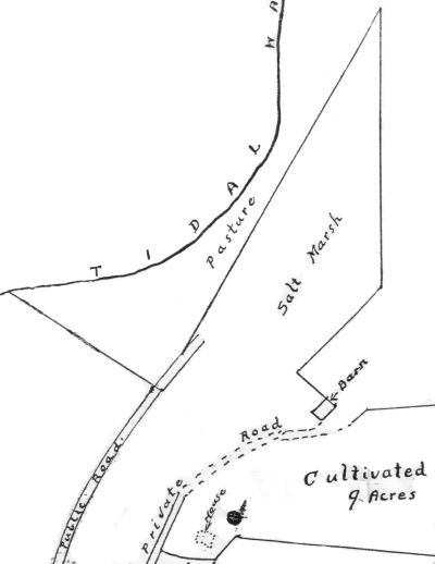
In 1935, Mrs Jake Sperry surveyed her property, which was sold in 1940 to Mr Ernie Himmelman (grandfather to the current generation). This survey does not appear to include an area noted as "salt marsh":
Note:
The above drawings were scanned from photocopies of the originals, then 'cleaned' to remove background paper, unnecesary detail etc primarily to reduce download times for those on dial-up connections.
|
|